40 Handheld Laser Range Finder
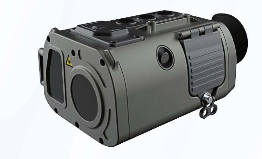
JV-LRFB06A is an intelligent portable monocular handheld laser rangefinder with built-in low-light camera module, laser rangefinder module, digital electronic compass, GPS positioning module, display module and central information processing unit, which integrates high-precision single-time ranging, continuous ranging, multi-target relative ranging, and storage and memory functions, and can be used for detecting and discovering the target during day and night, precise positioning, law enforcement records and auxiliary decision-making.
Handheld rangefinder, is based on the use of electromagnetic wave science, optics, acoustics and other principles and has a small body, for distance measurement instruments. Principle: handheld rangefinder in the work of a very thin beam of laser light to the target, by the photoelectric element to receive the target reflected laser beam, the timer to determine the laser beam from the time of emission to receive the time to calculate the distance from the observer to the target.

Feature
➢Reconnoiter and locate:Self-positioning horizontal accuracy ≤±3m、Target positioning accuracy ≤±20m
➢Multi-species ballistic solution:Measurement of meteorological parameters such as temperature, humidity and barometric pressure、Correctable wind deflection
➢High Precision Laser Ranging:Distance measurement accuracy ≤±2m、Accuracy rate ≥ 98%、Record the last 10 distance measurements
➢Multi-target Intuitive Relative Ranging:Relative ranging, altimetry, angularity
➢Fast and comfortable operation:Ergonomic design、Interface function operation guide
Technical paramater
Parameters / Model | JV-LRFB06A | |
visible light | ||
Resolution | 1920*1080 | |
Target size | 1/2.8 inch | |
Field of view | 8.5°* 4.8°~ 0.35°* 0.28° | |
Optical Magnification | 3.3×~80× | |
laser distance measurement | ||
Human eye safety/level | Class1/1M | |
laser wavelength | 1535±5nm | |
Maximum range | Large target | ≥5600 |
Vehicle | ≥4800 | |
Human | ≥3200 | |
UAV | ≥1700 | |
Minimum range | 50m | |
Measurement frequency | 1~10Hz | |
Ranging accuracy | ±1m | |
Accuracy rate | ≥98% | |
false alarm rate | ≤1% | |
Positioning components | ||
Positioning mode | Beidou/GPS/GLONASS multi-mode | |
Coordinate system | Geodetic coordinates / Gaussian coordinates / UTM Mercator / mgrs grid | |
Intelligent automatic correction of magnetic declination | ||
Automatically recognizes the magnetic declination of the machine's location (anywhere in the world), eliminating the need for manual correction. | ||
Electronic compass | ||
Azimuth measurement accuracy | 0.5° (RMS) | |
Pitch angle accuracy | 0.1° (RMS) | |
Demonstrate | ||
OLED | 0.55 inch | |
OLED Resolution | 1350*1080 | |
Working hours | ||
Continuous working time ≥ 7 hours | ||
External interface | ||
DC/USB/PAL/RS232 | ||
Related Products


Related News


Submitted successfully
We will contact you as soon as possible