

Laser Rangefinder 10km
➢Military-grade protection: IP67 dustproof and waterproof grade, adaptable to -40℃ to +60℃ extreme temperature range
➢Intelligent target recognition: support large target/vehicle/personnel/UAV classification, ≥98% recognition accuracy
➢Wide field of view imaging: 8.5°×4.8° to 0.35°×0.28° continuously adjustable FOV
➢Multi-spectral compatibility: 1/2.8” visible light sensor, 1920×1080 resolution
➢Easy to Operate:Interface functionality operation guide,Human-machine ergonomic design
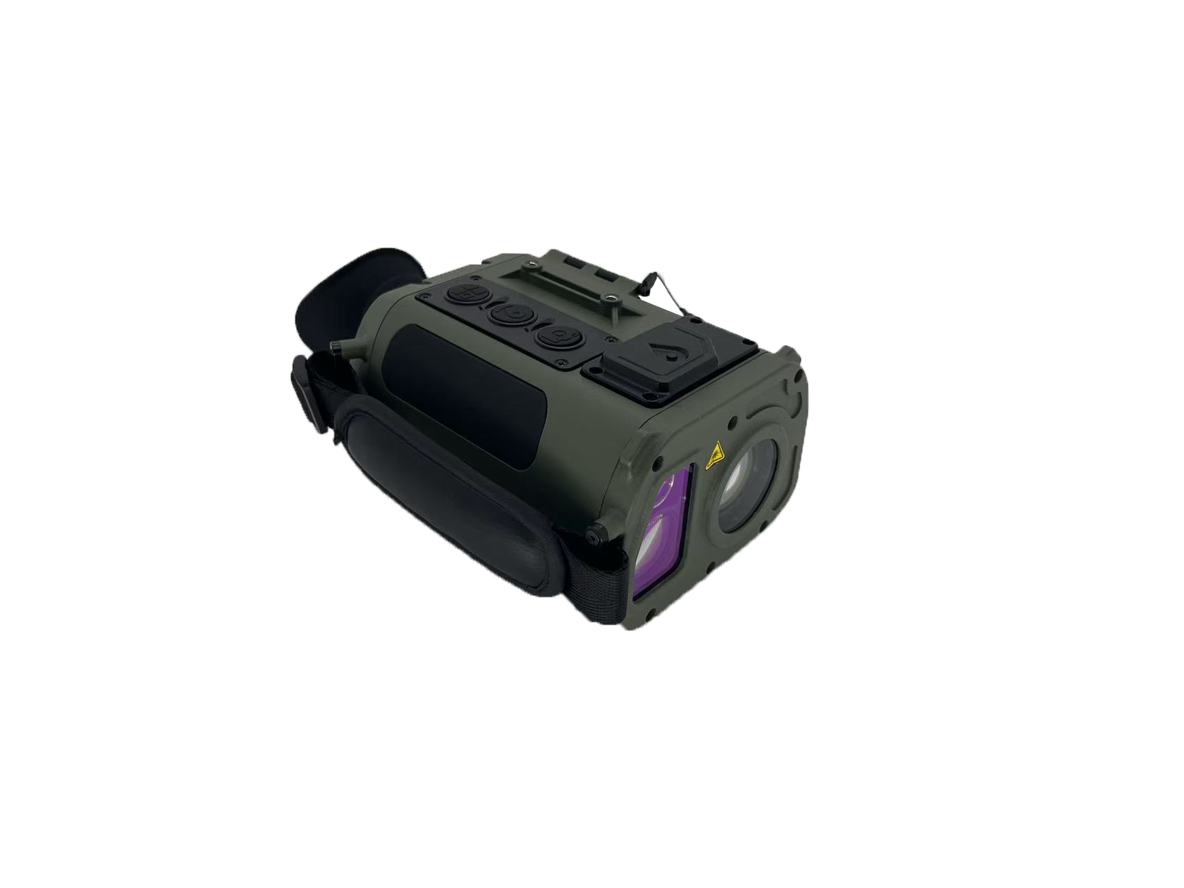
JV-LRFM10 is an intelligent portable monocular laser rangefinder. It is equipped with a low-light camera module, a laser ranging module, a digital electronic compass, a GPS positioning module, a display module, and a central information processing unit. It integrates high-precision single measurement, continuous measurement, multi-target relative measurement, and memory storage functions. This device can be used for day and night target detection and identification, precise positioning, law enforcement recording, and decision-making assistance.(Customizable binoculars)
Product pictures

Applications
Battlefield reconnaissance, target positioning, surrounding mapping, etc.


Technical parameter
Parameters / Model | JV-LRFM10 | ||
Visible Light | |||
Resolution | 1920*1080 | ||
Target surface dimensions | 1/2.8 in | ||
FOV | 8.5°*4.8°~0.35°*0.28° | ||
Optical magnification | 3.3×~80× | ||
Laser Rangefinding | |||
Eye safety/Level | Class1/1M | ||
Laser wavelength | 1535±5nm | ||
Max measuring range | Large target | ≥5600 | ≥10000 |
Vehicle | ≥4800 | ≥8000 | |
Human | ≥3200 | ≥4500 | |
UAV | ≥1700 | ≥2600 | |
Min measuring range | 50m | ||
Measurement frequency | 1~10Hz | ||
Distance measurement accuracy | ±1m | ||
Accuracy rate | ≥98% | ||
False alarm rate | ≤1% | ||
Positioning Component | |||
Positioning mode | BeiDou/ GPS/ GLONASS multi-mode | ||
Coordinate system | GCS/ Gauss-Kruger/ UTM/ MGRS | ||
Intelligent Automatic Correction of Magnetic Declination | |||
Automatic identification of local magnetic declination (at the specified location), eliminating the need for manual correction. | |||
Electronic Compass | |||
Azimuth accuracy | 0.5°(RMS) | ||
Pitch angle accuracy | 0.1°(RMS) | ||
Display | |||
OLED | 0.55 in | ||
OLED resolution | 1350*1080 | ||
Operating Hours | Continuous Operating Hours: ≥7h | ||
Environmental features | |||
Protection Level | IP67 | ||
Operating Temperature | -40°C~+60°C | ||
Weight | 1.18kg(with battery) | ||
Size(mm) | 205mm x 116mm x 85mm | ||
External Interfaces | DC/USB/PAL/RS232 | ||
Rapid startup | ≤30s | ||
Note
1) Vehicle target size: 2.3m×2.3m, human-shaped target size: 0.5m×1.7m, UAV-shaped target size: 0.2m×0.3m, reflectivity: 30%; visibility ≥12Km.
2) Vehicle target size: 2.3m×4.6m, human-shaped target size: 0.5m×1.7m, UAV-shaped target size: 0.2m×0.3m, reflectivity: 30%; visibility ≥12Km.


